Fire
Overview
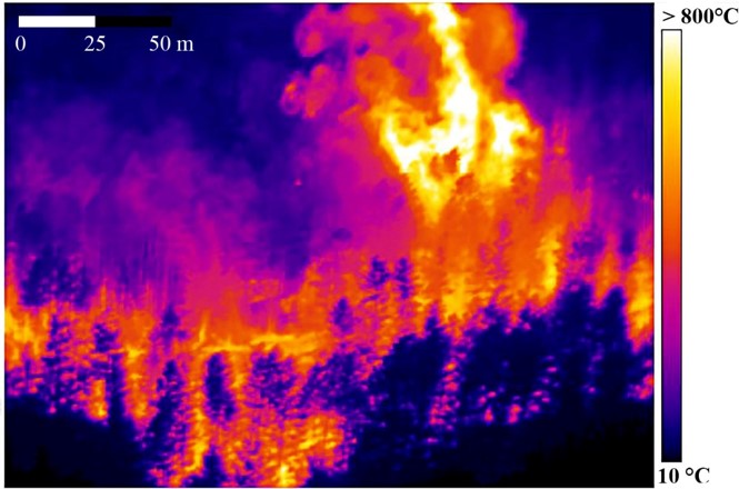
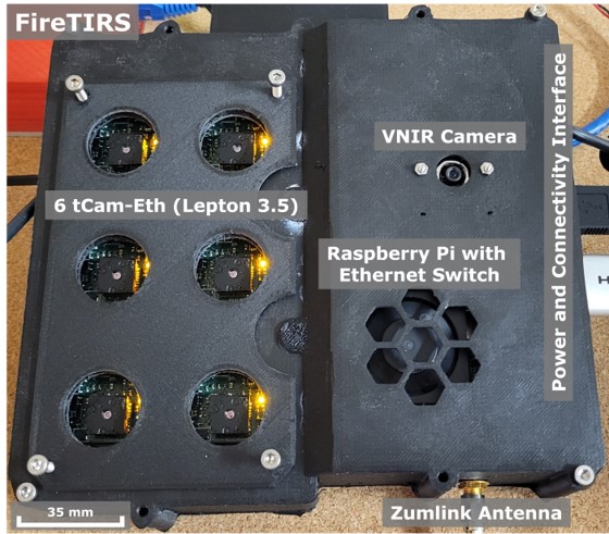
This project will develop thermal infrared (TIR) imaging systems (FireTIRS) with high spatial and temporal resolution that are small enough to be flown on unmanned aircraft systems (UAS). Current satellite-based TIR imagers have limited spatial resolution and long revisit times, but affordable, UAS-mounted spectrometers could provide near real-time insights to wildland fire commanders regarding thermal and gas dynamics, burn intensity, and rate of spread. The goal is to achieve sub-meter spatial and sub-second temporal resolutions, enabling the characterization of thermal convection gas emissions in 3D.
What are the thermal dynamics at wildfire fronts and the influence on burn intensity and spreading rate?
Active wildfires evolve quickly and have proven difficult to model. Multispectral TIR data of an entire wildfire can aid in active fire (hot spot) detection, fire movement over time, and plume characterization, all of which are vital for fire managers. High temporal resolution TIR data will improve the characterization of highly dynamic fire fronts, where temperatures fluctuate at 100s°C per second.
What components of fires determine the spatiotemporal emission and structure of important air pollutants (SO2, CO2, NH3)?
The high resolution TIR data will advance the derivation of critical gas flux rates in 3D (i.e., SO2, CO2, and NH3) to identify fire burn efficiencies and impact on the environment and air quality. The cross-calibration for thermal and gas retrievals will improve the characterization of emissions in 3D.
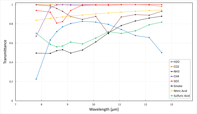
How do UAS-based multispectral TIR data provide fire extent and energetic information useful for incident command of prescribed and wildland fires?
Improve the performance, reliability, and latency metrics of multispectral TIR imaging systems, with integration on a small UAS to enable deployment during a wildfire event. A telemetry downlink will allow the processing and distribution of heat and gas flux 3D data into fire management systems with low latency, to aid in evaluating current fire behavior. The US Fish and Wildlife Service is partnering to test this technology.
What are the impacts of fire on vegetation and soils?
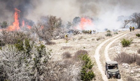
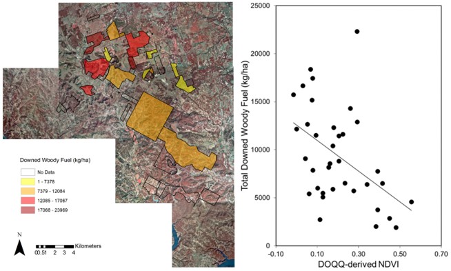
Prescribed burns are used to improve ecosystem function of managed lands through enhancing grass and forb diversity. Fuel moisture is important for constraining rates and energy release for burned organic matter, which are drivers in soil and vegetation response to fires.
Partners
